
| Home | Communities | Accommodations | Places To Go | Things To Do | Site Map |
|
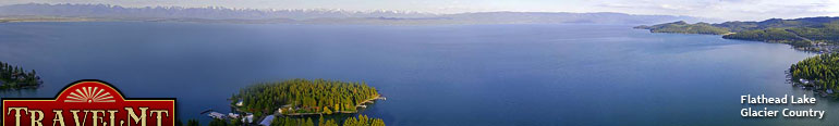
Glacier Country
Central Montana
Missouri River Country
Southwest Montana
Yellowstone Country
Southeast Montana
|
Name | City | ||
| East Fork Trail and Snowmobile Route From Philipsburg go south on Montana Highway 1 for 13.5 miles, then west on Denton's Point Road 672 for 4.0 miles to East Fork Snowmobile Parking Area... | Philipsburg | ||
| East Morrell - Blind Canyon Snowmobile Trail East Morrell - Blind Canyon Snowmobile Trail is located out of Seeley Lake.... | Seeley Lake | ||
| East Rosebud-Camp Senia Trail ... | Red Lodge | ||
| East Spread Mountain Trail Start at the McCabe Creek Trailhead that is accessed by the Monture Creek Road, north of Ovando, Montana. (See Lolo Travel Plan Maps)... | Seeley Lake | ||
| Eddy Ridge Trail Turn south off of State Highway 200 approximately 2 miles west of Thompson Falls, Montana. onto the Prospect Creek Road (Highway 7) go approximately 1... | Plains | ||
 | Edith Lake Trail Travel east of Townsend on US Highway 12 approximately 11 miles, then north on Forest Road 423 (North Fork of Deep Creek). Follow road for approximat... | Townsend | |
 | Edith Lake Trail From Philipsburg go south on Highway 1 for 6.4 miles, than west on Highway 38 for 9 miles, than west and south on Forest Service Road 5106 for 15 mile... | Philipsburg | |
| Eight Mile Harvey Trail From Philipsburg go north on Highway 1 for 18.2 miles to Hall, than west on Road 358 for 21.2 miles to trailhead.... | Philipsburg | ||
| Eight Mile Trail #22 From Philipsburg go north on Highway 1 for 18.2 miles to Hall, than west on Road 358 for 17.2 miles, than down Forest Service Road 78597 for 0.2 miles... | Philipsburg | ||
| Elk Calf Trail Take Highway 2 west from East Glacier or east from Columbia Falls to the summit of Marias Pass on the Continental Divide, just south of Glacier Nation... | Choteau | ||
| Elk Mountain Trail From Trego, travel south 14 miles on Road 36. Turn onto Twin Meadows Creek Road 3520 and travel 2 miles, then turn south onto Road 3503. Proceed 3.5... | Fortine | ||
| Elk Mountain Trail Elk Mountain Trail can be accessed from US Highway 2 and by taking the Fielding-Coal Creek Trail.... | Glacier National Park | ||
| Elk Patrol Trail From Trego, travel south 16 miles on Road 36. Turn on Road 3500 and follow for 2.5 miles to the first switch back. Parking is available for three ve... | Fortine | ||
| Elk River Trail Follow US Highway 287 south 35 miles from Ennis to the West Fork of the Madison River. Make a right at the rest area and cross the Madison River on L... | Ennis | ||
| Elkhorn Hot Springs Ski Trail From Dillon travel 3 miles south on I-15 to Highway 278 for 22 miles to the Junction of the Wise River Polaris Road 484.5 travel north for 13 miles to... | Polaris | ||
| Emerine Trail #16 From Philipsburg go south on Highway 1 for 6.4 miles than west on Highway 38 for 22.7 miles, than south on Forest Service Road 5070 for approximately ... | Philipsburg | ||
| Essex Ski Trail Complex At Essex, just off US Highway 2, halfway between East and West Glacier in northwest Montana on the southern tip of Glacier National Park. Trailhead a... | Hungry Horse | ||
| Estler Lake Trail From Dillon travel north on I-15 for 12 miles. Then 12 miles west on the Birch Creek Road 98.2, 5 miles north to the Minneopa Lake Trailhead. To get... | Dillon | ||
| Evans Gulch Trail See Lolo West Forest Travel Plan Map. Turn south off of Forest Highway 7, the Prospect Creek Road at the junction with Forest Road 7627, the Evans Gu... | Plains | ||
| Falls Creek Trail Take Highway 12 north from Townsend for 2 miles to the Indian Creek Road 360 and follow this road for approximately 7 miles to the junction with the W... | Townsend | ||
| <-- Previous | Next --> | ||
A source for Montana Travel & Tourism Information
![]()