
| Home | Communities | Accommodations | Places To Go | Things To Do | Site Map |
|
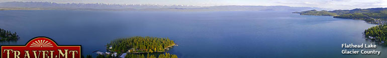
Glacier Country
Central Montana
Missouri River Country
Southwest Montana
Yellowstone Country
Southeast Montana
|
Name | City | ||
| Lolo Pass Snowmobile Trail Lolo Pass is on US Highway 12 at the Montana-Idaho border, 45 miles southwest of Missoula.... | Lolo | ||
| Lolo Peak Trail From Highway 12, south of Lolo, about 3 miles, take the Mormon Peak Road 612. 8.5 miles up the road there's a switchback with parking for 3 cars and ... | Missoula | ||
 | Lone Pine Overlook Trail Lone Pine State Park is located 4 miles southwest of Kalispell on Foyes Lake Road, then 1 mile east on Lone Pine Road. The trail is located within th... | Kalispell | |
| Loneman Lookout Trail The Loneman Lookout can be reached by taking starting at the Nyack trailhead on the north bank of the Middle Fork of the Flathead River. Nyack Creek... | Glacier National Park | ||
| Lonesome Ridge Trail Take US Highway 89 north from Choteau 5 miles. Turn west on the Teton River Road 144 and go 17 miles to the South Fork Teton Road 109. Continue for ... | Choteau | ||
| Longfellow Park Trail Take Highway 12 north from Townsend for 2 miles to the Indian Creek Road 360 and follow this road for about 7 miles to the junction with the Weston Cr... | Townsend | ||
| Lookout Pass Ski Trails On I-90, take Exit 0 on the Montana/Idaho border. The ski trailhead is on the south side of the overpass. Park in the lower half of the developed sk... | Superior | ||
 | Lost Cabin Lake Trail From Interstate 90 take Cardwell exit 7 miles east of Whitehall. Take Montana Highway 359 south for approximately 5 miles to South Boulder Road 107. ... | Whitehall | |
| Lost Creek Falls Trail Lost Creek Falls Trail is located in Lost Creek State Park. 1.5 miles east of Anaconda on Montana 1, then 2 miles north on Secondary 273, then 6 mile... | Anaconda | ||
| Lost Girl/St. Paul Peak Ski Course From Junction with Montana 200 and Montana 56, turn onto Montana 56 and travel approximately 5 miles to Road 407. Turn and follow 1 mile to the trail... | Trout Creek | ||
| Lost Horse Trail Trail is located 6 miles up the Pattengail drainage from the Pattengail Trailhead. A rough jeep road follows the north side of Pattengail Creek but s... | Wise River | ||
| Lost Stove Trail Travel 16.1 miles northwest on Forest Road 839 from US Highway 89 at Kings Hill junction of Forest Road 839 and 3484. Then travel 4 miles southwest o... | White Sulphur Springs | ||
| Loveland Peak Trail From Noxon, travel west 4 miles on County Road. Turn left onto Smeads Bench Road 2706. Keep right at the road fork and proceed 9 miles to the end of... | Trout Creek | ||
| Lower Deer Creek Trail Lower Deer Creek Trail is located 19 miles south of Big Timber on US Highway 298, 3 miles east on East Boulder Road, 3 miles east on Elk Creek Road, c... | Big Timber | ||
| Lower Siamese Trail I-90 West from Missoula take Exit 66, Fish Creek Road. Take Fish Creek Road 343 south approximately 9 miles, turn west on West Fish Creek 7750 for app... | Huson | ||
 | MacDonald Pass Trail Travel west from Helena on Highway 12 approximately 14 miles to the parking area on the north side of Highway 12. Parking is provided just off of Hig... | Helena | |
| Maclay Flats Interpretive Trail From Highway 93 south, cross the Bitterroot River, and take the Blue Mountain County Road on the right. Go past the horse trailhead where the asphalt... | Missoula | ||
| Madison Arm Loop Snowmobile Trail Madison Arm Loop Snowmobile Trail is located out of West Yellowstone.... | West Yellowstone | ||
| Magpie System Snowmobile Trail Access the Magpie Trail System from Canyon Ferry and Magpie Road.... | Helena | ||
| Marthas Basin Trail ... | Glacier National Park | ||
| <-- Previous | Next --> | ||
A source for Montana Travel & Tourism Information
![]()